2018-05-27

Cicero's Witness

I've blogged a couple of times before (here and here) about the world's most famous unreturned library book, the unique copy of Cicero's guide to oratory in the bishop's palace at Lodi. It has not been seen since 1425, but fortunately multiple copies were made before it vanished.

This week, the Vatican's digitization portal placed online Vat.lat.3237, a valuable secondary witness to the content of the so-called Codex Laudensis.

There's a detailed article by Paola Scarcia Piacentini, La tradizione laudense di Cicerone ed un inesplorato manoscritto della Biblioteca Vaticana (Vat. Lat. 3237), about it. De Oratore, as I have mentioned, is especially important as a source for Cicero's theories of memory and visualization, and thus a landmark in the history of cognitive science.

In the past week, the portal released 54 new digitizations:
  1. Borg.ebr.21,
  2. Urb.lat.286,
  3. Vat.gr.1155, DigiVatLib announced this Gospels on Twitter simultaneous with release:
  4. Vat.lat.2237,
  5. Vat.lat.2241,
  6. Vat.lat.2275,
  7. Vat.lat.2279,
  8. Vat.lat.2766,
  9. Vat.lat.2846,
  10. Vat.lat.3140 (Upgraded to HQ),
  11. Vat.lat.3142,
  12. Vat.lat.3144 (Upgraded to HQ),
  13. Vat.lat.3145,
  14. Vat.lat.3148,
  15. Vat.lat.3149,
  16. Vat.lat.3150 (Upgraded to HQ),
  17. Vat.lat.3153,
  18. Vat.lat.3159,
  19. Vat.lat.3171,
  20. Vat.lat.3176 (Upgraded to HQ),
  21. Vat.lat.3186 (Upgraded to HQ),
  22. Vat.lat.3188 (Upgraded to HQ),
  23. Vat.lat.3189,
  24. Vat.lat.3191,
  25. Vat.lat.3194 (Upgraded to HQ),
  26. Vat.lat.3215 (Upgraded to HQ),
  27. Vat.lat.3220,
  28. Vat.lat.3228 (Upgraded to HQ),
  29. Vat.lat.3231,
  30. Vat.lat.3232,
  31. Vat.lat.3234,
  32. Vat.lat.3237, Cicero, De Oratore, useful in recovering the Codex Laudensis (above)
  33. Vat.lat.3238 (Upgraded to HQ),
  34. Vat.lat.3241,
  35. Vat.lat.3242,
  36. Vat.lat.3244,
  37. Vat.lat.3253 (Upgraded to HQ), 11th-century Virgil, Georgics and Aeneid, one of Lowe's examples of Beneventan script.
  38. Vat.lat.3254,
  39. Vat.lat.3257,
  40. Vat.lat.3258,
  41. Vat.lat.3260,
  42. Vat.lat.3262 (Upgraded to HQ), 11th-century Ovid, Fasti. One of Lowe's examples of Beneventan script.
  43. Vat.lat.3264, yet another of the five Fabio Mazzatosta codices, this time the Fasti of Ovid
  44. Vat.lat.3271,
  45. Vat.lat.3274 (Upgraded to HQ),
  46. Vat.lat.3275,
  47. Vat.lat.3276,
  48. Vat.lat.3278 (Upgraded to HQ),
  49. Vat.lat.3288,
  50. Vat.lat.3296,
  51. Vat.lat.3308,
  52. Vat.lat.3310,
  53. Vat.lat.3341 (Upgraded to HQ),
  54. Vat.lat.13985, Officium Beatae Virginis secundum consuetudinem Sanctimonialium Monasterii Sanctae Mariae de Virginibus de Venetiis, 14th-15th century
This is Piggin's Unofficial List number 162. Thanks to @gundormr for harvesting. If you have corrections or additions, please use the comments box below. Follow me on Twitter (@JBPiggin) for news of more additions to DigiVatLib.

2018-05-24

Via Appia Found on Satellite Image

The Appian Way is perhaps the world's most celebrated road. On the outskirts of Rome it is a major tourist attraction. I have just discovered you can see some of its far reaches on photographs from space.

The Way seems to be the source of a common misconception in the English-speaking world that all Roman roads were solidly paved and ran straight as a laser, up hill and down dale, never yielding to the lie of the land. Beyond Terracina, much of the Via Appia was neither paved nor straight, but wriggled along long-worn prehistoric ridgeway routes, where the ground was drier (and harder) and the traveler had the best chance of spotting approaching attackers, whether they were bandits or bears.

Begun under the direction of Appius Claudius, a consul, in 312 BCE, the Via Appia initially connected Rome to Capua near Naples. Later it was extended to Brindisi on the Adriatic Coast. It was any physical traces of this latter extension that I was hoping to find while on a visit last week to Italy.

We were staying in the newly elegant city of Matera which is dolling itself up to be one of two European Capitals of Culture of 2019. In Roman times, Matera was just a remote warren of hand-hewn caves, never mentioned in the ancient sources. Perhaps it was a refuge of the above-mentioned bandits, who could murder a merchant on the Via Appia at dusk and carry the booty 15 kilometers away to the caves to hide it, safely holed up by midnight like the Ahlbergs' brigands:

Near Matera one finds two modern highways named Via Appia. The one beginning from Ferandina, national highway SS7, and proceeding via Matera to Massafra is a fake, although it too terminates at Brindisi. The other, Puglia provincial road SP28, marked "Strada Provinciale Appia" on maps, is, in some stretches at least, the real thing.

Recent articles by Luciano Piepoli dispense with the armchair scholarship (mainly German) about this part of the Via. They assemble new hard archaeological evidence about its course and stage-stops. Unfortunately Piepoli does not provide GIS geolocations (this ought to be prescribed by the style guides of every journal dealing with historical geography). He writes:
The Appian Way, at the exit from the current town of Gravina in Puglia, begins its path in a south-easterly direction near Scomunicata and, after having touched the localities of Graviscella and Ponte Padule Cardena, reaches the rocky outcrop of the Murgia Catena, located about 7 km southeast of Altamura. The road runs along the southern slope of this last location to Iesce, where there are the remains of an important settlement that had been abandoned by the 2nd century B.C. On the territory of Altamura, in a flat section between the southern slope of the Murgia Catena and the hillock of Montepovero, the projecting traces of wheel ruts are visible in the rocky surface for a length of about 200m and a total width of more than 30m, forming multiple lanes. Although they are not contemporary with one another, it appears highly probable by virtue of their topographical location that some of them must derive from the consular Via Appia. (My English, helped by Apple and Google Translate).
Hoping to see these traces of the wheels of ancient or medieval carts, we stopped our car on the shoulder of the SP28 at what we thought was the spot. Since a narrow lane of wheat was growing there on the verge of the road itself, we searched the rocky field behind it, but to no avail. On the point of giving up, and after nearly stepping on a sturdy snake, I finally discovered the ruts further up the road.

In the 50-second video above you may hear a cicada and will see the colorful wild flowers of a southern Italian spring including tall fennel, all growing in the dirt that has collected in the ruts.

The most pronounced track is at the left, close to the dry-stone wall. There are no doubt specialists who could estimate from the wheelbase whether this track is ancient or medieval. A second, shorter bunch of tracks can be found about 50m further down the hill (in a 24-second video). I have uploaded videos of both to my YouTube Channel.

The greatest surprise came later: these ruts are visible on common garden satellite imagery. When I studied the same location on Google Maps later, I was amazed to see the big set of ruts quite clearly at the location 40.76424, 16.61516 (tip: copy just this to any sat-nav or mapping app to find it):

As far as I know, this remarkable, aerially visible archaeological site is not listed on any of the ancient geographical portals such as the Digital Atlas of the Roman Empire, Pelagios or Vici. I can see how to add it to Vici (and will add it later), but I must admit that I have no idea yet how to contribute it to the former two. They do not offer any "guide for dummies" instructions.

These stone remains are no longer 30 meters wide, since the new road passes through the middle, and they do not seem to have gained any legal protection, although the feature is surely known locally. The IGM map of 1919 (reproduced as British AMS M791 of 1939) labels a nearby stretch of the road "od via antica Via Appia" (I don't know what "od" means).

Piepoli relies on a survey of the area by the great aerial archaeologist of the 1920s to the 1950s, Giuseppe Lugli, so I presume these remains are mentioned in Lugli's books or articles. As far as I can tell, they are the only surface evidence left of the ancient Via Appia between Gravina and Tarento.

The fact that wheels ran across bedrock here is an indication that the highway was unpaved. A few kilometers away, the route has been archaeologically excavated. Piepoli writes:
Near Masseria Capitolicchio Vecchia, recent excavations conducted by the Archaeological Superintendency of Puglia have highlighted a short stretch (about 200 x 4.90 m) of a road - of the glareata type - interpreted, on the basis of the construction technique, orientation and topographic context, as a segment of the Appian Way [Mattioli, 2002]. An interesting fact which emerged during the excavations is that the roadway is partially obliterated by a layer of relative collapse likely due to a structure located near the road axis. The ceramic finds and coins found can be dated between the end of the 2nd century BC and the 3rd century AD, which could be considered as a terminus post quem for the abandonment of the Via Appia in this section.
The simple glareata road had a base of stones, built up to a sand or gravel surface, and would be kicked or ground apart by heavy traffic if it were not maintained. This is probably what happened at 40.76424, 16.61516, exposing the bedrock to the grinding of cart and carriage wheels. Above, I mentioned a narrow crop of wheat growing in the queen's acre (the roadside). It too is clearly visible in the space imagery, and occupies what seems to have once been a ford through a seasonal stream, the Vulle. No doubt the silt, organic particles and the churning of the wheels created a fertile slough in this rocky landscape which, as the 1919 map shows, travelers had to edge around.

Most of the Via Appia in this area follows the watershed. Here's a more open location, looking towards the Murgia Catena from the north-west, where you may be able to see that the land slopes very lightly away to both sides.

To the left of this spot, the drop to the base of the valley is quite substantial, as the next image shows:

In an article this year, the scholar Tønnes Bekker-Nielsen compares the posterity of this southern Via Appia built in the 3rd century BCE to the highly engineered Via Traiana built with cuttings and bridges in the 2nd century CE. The bridges ultimately fell down, whereas the prehistoric footpaths and droving tracks along the watersheds proved indestructible. The self-maintaining character of ridgeway routes even after all their gravel has eroded away is the reason that the Via Appia remained in continuous medieval and modern use and was then resurfaced in the 20th century:
For the Roman traveler, the Via Traiana was a significant improvement. It was shorter, had far fewer inclines and declines and was less vulnerable to snowfall. But despite the many advantages of the Via Traiana, it is the Via Appia which has survived to this day. An estimated 90% of the total length of the Appia is still in use as graveled or asphalt road. Large portions of the Via Traiana, on the other hand, are overgrown and impassable. (My assisted translation from the Danish.) 
Bekker-Nielsen, Tønnes. ‘Romerske Veje i Syditalien: Via Appia Og via Traiana’. Vejhistorie, 2018. Academia.edu

Piepoli, Luciano. ‘Blera e Sub Lupatia (It. Ant. 121,4-5): Proposte per l'identificazione di due stazioni itinerarie lungo il tratto apulo della via Appia’. In Statio amoena: Sostare e vivere lungo le strade romane, edited by Patrizia Basso and Enrico Zanini. Oxford: Archaeopress, 2016.  Academia.edu

———. ‘Il percorso della via Appia antica nell'Apulia et Calabria: Stato dell'arte e nuove acquisizioni sul tratto Gravina-Taranto’, in Vetera Christianorum, 51, 2014, 239-261’. Academia.edu.

2018-05-22

First Accounting Handbook

Luca Pacioli, the mathematician who instructed Leonardo da Vinci and for a time lived in the same house, hand-wrote a remarkable textbook, the Tractatus mathematicus ad discipulos perusinos, for his students at the University of Perugia, where Pacioli taught from 1477 to 1480.

This celebrated source-book of merchant arithmetic, preserved as Vat.lat.3129 at the Vatican Library, is seen as the start of the formal study of accounting. A color scan has just been presented online, replacing a murky black and white image on the library portal. It is among the most celebrated items to emerge from the digitization program in the past week. Below is the full list of 107 items:
  1. Barb.gr.283,
  2. Barb.lat.3867,
  3. Chig.L.IV.106.pt.A,
  4. Ott.lat.349,
  5. Ott.lat.3371,
  6. Vat.gr.1159,
  7. Vat.gr.1229,
  8. Vat.lat.2261,
  9. Vat.lat.2268,
  10. Vat.lat.2269,
  11. Vat.lat.2314, Summa Hostiensis with notable arbor juris diagrams:
  12. Vat.lat.2321,
  13. Vat.lat.2331,
  14. Vat.lat.2352,
  15. Vat.lat.2377,
  16. Vat.lat.2402,
  17. Vat.lat.2405,
  18. Vat.lat.2409,
  19. Vat.lat.2425,
  20. Vat.lat.2451,
  21. Vat.lat.2463 (Upgraded to HQ),
  22. Vat.lat.2480,
  23. Vat.lat.2674,
  24. Vat.lat.2682,
  25. Vat.lat.2684,
  26. Vat.lat.2702,
  27. Vat.lat.2745,
  28. Vat.lat.2830,
  29. Vat.lat.2840,
  30. Vat.lat.2848,
  31. Vat.lat.2849,
  32. Vat.lat.2857,
  33. Vat.lat.2895,
  34. Vat.lat.2902,
  35. Vat.lat.2945,
  36. Vat.lat.2990,
  37. Vat.lat.2995,
  38. Vat.lat.3028,
  39. Vat.lat.3048 (Upgraded to HQ),
  40. Vat.lat.3051,
  41. Vat.lat.3053,
  42. Vat.lat.3058 (Upgraded to HQ),
  43. Vat.lat.3059,
  44. Vat.lat.3062,
  45. Vat.lat.3067,
  46. Vat.lat.3068,
  47. Vat.lat.3069,
  48. Vat.lat.3070, See eTK
  49. Vat.lat.3076 (Upgraded to HQ),
  50. Vat.lat.3079,
  51. Vat.lat.3080,
  52. Vat.lat.3082 (Upgraded to HQ),
  53. Vat.lat.3084,
  54. Vat.lat.3086,
  55. Vat.lat.3088, See eTK
  56. Vat.lat.3089,
  57. Vat.lat.3095,
  58. Vat.lat.3099, See eTK
  59. Vat.lat.3101 (Upgraded to HQ), See eTK
  60. Vat.lat.3103, See eTK
  61. Vat.lat.3104,
  62. Vat.lat.3105,
  63. Vat.lat.3107, an almanac for Pope Paul II by Nicholas Germanus. See eTK. This was exhibited in the Rome Reborn show, and Anthony Grafton's catalog calls it an "uncommonly beautiful example of an almanac, computed for the years 1466 to 1484". Here is the partial solar eclipse on April 26, 1473 predicted and illustrated:
  64. Vat.lat.3109,
  65. Vat.lat.3111,
  66. Vat.lat.3112 (Upgraded to HQ),
  67. Vat.lat.3113,
  68. Vat.lat.3114,
  69. Vat.lat.3116,
  70. Vat.lat.3117,
  71. Vat.lat.3118 (Upgraded to HQ),
  72. Vat.lat.3119,
  73. Vat.lat.3121, See eTK
  74. Vat.lat.3122 (Upgraded to HQ),
  75. Vat.lat.3124 (Upgraded to HQ),
  76. Vat.lat.3126,
  77. Vat.lat.3127,
  78. Vat.lat.3129 (Upgraded to HQ), Luca Pacioli (above)
  79. Vat.lat.3130 (Upgraded to HQ),
  80. Vat.lat.3133,
  81. Vat.lat.3134 (Upgraded to HQ),
  82. Vat.lat.3135,
  83. Vat.lat.3137,
  84. Vat.lat.3141 (Upgraded to HQ),
  85. Vat.lat.3146,
  86. Vat.lat.3152,
  87. Vat.lat.3154,
  88. Vat.lat.3155,
  89. Vat.lat.3158,
  90. Vat.lat.3160,
  91. Vat.lat.3162,
  92. Vat.lat.3163,
  93. Vat.lat.3164,
  94. Vat.lat.3166, See eTK
  95. Vat.lat.3167,
  96. Vat.lat.3168 (Upgraded to HQ),
  97. Vat.lat.3172,
  98. Vat.lat.3177,
  99. Vat.lat.3178,
  100. Vat.lat.3179,
  101. Vat.lat.3182,
  102. Vat.lat.3209,
  103. Vat.lat.3211 (Upgraded to HQ),
  104. Vat.lat.3213 (Upgraded to HQ),
  105. Vat.lat.3240,
  106. Vat.lat.3769,
  107. Vat.lat.3839 (Upgraded to HQ),
This is Piggin's Unofficial List number 161. Thanks to @gundormr for harvesting. If you have corrections or additions, please use the comments box below. Follow me on Twitter (@JBPiggin) for news of more additions to DigiVatLib.

2018-05-12

Early Physics

Basic ideas of modern physics go back well beyond Isaac Newton to the English scientist Richard Swineshead, who enters the scene in about 1340 as one of the Oxford Calculators. These brilliant men were interested in velocity, force and other values, and drew on mathematical work by Thomas Bradwardine (c.1300 – 26 August 1349), who went on to become Archbishop of Canterbury.

Younger scholars were hard pressed initially to make sense of their equations, and this week's batch of Vatican Library digitizations includes one codex, Vat.lat.3064, with traces of that student shock. I will let John E. Murdoch's Album of Science: Antiquity and the Middle Ages, Topic 256, (1984) take up the story:
Another tractate of Swineshead's Liber calculationum applied Bradwardine to a quite specific problem. Briefly put, the problem was whether a thin rod in free fall near the center of the universe will ever reach that center in the sense that the center of the rod will eventually coincide with the center of the universe. The problematic part of the question derived from the fact that as soon as any part of the rod passes the center of the universe, that part may be considered a resistance against the rod's continued motion.

Assuming that the rod acts as the sum of its parts and that the relevant forces and resistances determined by these parts follow Bradwardine's "law," Swineshead concludes that the center of the rod will never reach the center of the universe (which is correct, under the assumptions made, since the time intervals for each increment of distance will increase ad infinitum). The marginal sketch [...] accompanies this particular text of Swineshead in a fourteenth-century manuscript of his work. Possibly drawn by a reader trying to puzzle his way through this segment of the "Calculator," the rod (here termed terra simplex to indicate that it is a heavy body) is appropriately divided into parts, one of them depicted as already having passed the center of the universe, which is duly labeled centrum mundi.
The list of 71 new Vatican digitizations follows. This is the first issue of Piggin's Unofficial List (PUL) on the blog for three weeks, because the busy technical people on the Vatican digitization program have been busy with some other tasks in the meantime:

  1. Barb.or.109,
  2. Barb.or.151.pt.2, a printed world map in Chinese, with just a teensy bit of the northern tip of Australia, still contemplated at the time as part of the Great Southern Continent
  3. Borg.lat.677,
  4. Chig.L.IV.106.pt.B,
  5. Ott.lat.3369,
  6. Ott.lat.3370,
  7. Reg.lat.473,
  8. Reg.lat.1501 (Upgraded to HQ),
  9. Reg.lat.1716 (Upgraded to HQ),
  10. Vat.copt.61 (Upgraded to HQ),
  11. Vat.copt.68 (Upgraded to HQ),
  12. Vat.gr.1153,
  13. Vat.gr.1154,
  14. Vat.gr.1158,
  15. Vat.gr.1176,
  16. Vat.gr.2306.pt.A,
  17. Vat.lat.2028 (Upgraded to HQ), early-15th century cosmology, Laurenzo Bandini, initials and diagrams never completed. See eTK
  18. Vat.lat.2213,
  19. Vat.lat.2235,
  20. Vat.lat.2278,
  21. Vat.lat.2315,
  22. Vat.lat.2337,
  23. Vat.lat.2388 (Upgraded to HQ), 14th century copy of Albertus Magnus on physiology and medicine, also passages of Galen. See eTK
  24. Vat.lat.2406,
  25. Vat.lat.2511,
  26. Vat.lat.2735,
  27. Vat.lat.2772,
  28. Vat.lat.2774,
  29. Vat.lat.2821,
  30. Vat.lat.2879,
  31. Vat.lat.2947,
  32. Vat.lat.2950,
  33. Vat.lat.2981,
  34. Vat.lat.2989, Aristotle, De Anima, see eTK
  35. Vat.lat.2991 (Upgraded to HQ),
  36. Vat.lat.2992,
  37. Vat.lat.2996 (Upgraded to HQ),
  38. Vat.lat.2997 (Upgraded to HQ),
  39. Vat.lat.2999,
  40. Vat.lat.3000,
  41. Vat.lat.3001,
  42. Vat.lat.3002,
  43. Vat.lat.3003,
  44. Vat.lat.3005,
  45. Vat.lat.3019,
  46. Vat.lat.3025,
  47. Vat.lat.3027 (Upgraded to HQ), Nicolas Perotti's translation of Hippocrates and other medicine texts from Greek to English, see eTK
  48. Vat.lat.3031,
  49. Vat.lat.3037,
  50. Vat.lat.3038, logical and scientific texts by William Heytesbury, Richard Billingham and Petrus de Candia, see eTK
  51. Vat.lat.3041,
  52. Vat.lat.3042,
  53. Vat.lat.3046,
  54. Vat.lat.3050,
  55. Vat.lat.3052,
  56. Vat.lat.3056,
  57. Vat.lat.3060,
  58. Vat.lat.3061 (Upgraded to HQ),
  59. Vat.lat.3064, Swineshead, Liber calculationum, above.
  60. Vat.lat.3065 (Upgraded to HQ), Richard Billingham on logic, see eTK
  61. Vat.lat.3072 (Upgraded to HQ),
  62. Vat.lat.3075,
  63. Vat.lat.3081,
  64. Vat.lat.3093,
  65. Vat.lat.3094,
  66. Vat.lat.3115,
  67. Vat.lat.3181,
  68. Vat.lat.3229 (Upgraded to HQ), 15th-century Pomponius Leto work dealing with Cicero
  69. Vat.lat.3265,
  70. Vat.lat.3286, Juvenal, with copious glosses, elaborate initials (below), one of Lowe's examples of Beneventan script, marked in "Juvenale, in lettera Langebardo" on the flyleaf
  71. Vat.lat.3309 (Upgraded to HQ), Horace, with flyleaves from older manuscript
This is Piggin's Unofficial List number 160. Thanks to @gundormr for harvesting. If you have corrections or additions, please use the comments box below. Follow me on Twitter (@JBPiggin) for news of more additions to DigiVatLib.

2018-05-07

This Oldest Map is a Beauty

The oldest surviving Latin diagram of the world was rediscovered by accident in the Vatican Library in the 1920s. Youssouf Kamal (1882-1965), an Egyptian prince and aesthete, had financed a huge undertaking to publish a collection of ancient maps depicting Africa fully or obliquely. While combing through the Vatican, the scholars stumbled on a lavish, full-page colored spread, folios 64v-65r in Vat.lat.6018, which had been completely overlooked in all previous historical research.

A few weeks ago I digitally plotted a simpler diagram of similar age which is now held by the archives of Albi, France and has been recognized as a UNESCO world heritage treasure. The Vatican Mappamundi was drawn in about 760 or 770 CE and has been a good deal more difficult to plot, since the photographic images compress the central part into the gutter of the book binding.


This is the first-ever color plot to be published. Zoom in and you will see that the diagram has south at the top and therefore Europe at bottom right. The scribe evidently turned the parchment as he worked and wrote place names from every side.

Six cities are represented by star-shaped symbols: Constantinople, Rome, Alexandria, Carthage, Jerusalem and Babylon. The big island at left is Sri Lanka and at lower right are the British Isles. The meaning of the "fourth continent" at top right has been much debated. The crescenty things on the rim are thought to represent sun and moon.

The current received wisdom is that this is a Christian adaptation of a diagram which had been used to teach (secular) geographical knowledge in late antique schools in the Latin West. The Vatican Mappamundi is probably contemporary with the original of the 12th-century Tabula Peutingeriana, a Latin diagram in roll form which shows the whole known world as a very long strip. My view is that abstract diagrams (of which both are fine examples) are an invention of late antiquity, not earlier.

For this digital plot I used the Vatican Library's scans, uncurling the center part with the lattice deformation tool in Inkscape. The transcriptions are mostly Francois Glorie's, while a black and white engraving by Menéndez Pidal helped decode some of the ambiguities. The color adaptation is my own. The SVG file will soon appear in my Library of Latin Diagrams where you will be able to read it with a tablet computer and rotate it to your heart's content.

Now, back to the discoverer. Prince Youssouf belonged to a dynasty of Albanian origin who ruled Egypt until the army-led revolution of 1952. Through polygamy it was a large family and Youssouf held back from the jostling for leadership, instead founding seats of learning and cultivating the arts. Such was his wealth that he built three palaces and financed culture.

He seems to have been interested in two major topics: the depiction of North Africa in ancient cartography and the contributions of Islamic learning to cartography. That is why he financed the Monumenta cartographica Africae et Aegypti, a catalogue of facsimile images of manuscript maps.

He is listed as author, but the research and compilation was done by Frederik Caspar Wieder (1874-1943) of the Netherlands. Only 100 copies of the 16-part series published in Cairo between 1926 and 1951 were ever printed, with a few sold to collectors and most given away to libraries and institutions. It was never digitized, meaning it is a very hard-to-access resource.

Chekin, L. S. (1999). Easter tables and the Pseudo-Isidorean Vatican map. Imago Mundi, 51(1), 13–23. DOI 10.1080/03085699908592900.
Edson, E. (1998). Mapping Time and Space: How Medieval Mapmakers Viewed Their World. London: British Library.
Englisch, B. (2002). Ordo Orbis Terrae: Die Weltsicht in den Mappae mundi des frühen und hohen Mittelalters. Akademie Verlag.
Glorie, F. (1965). Mappa Mvndi (Vat. lat. 6108). In P. Geyer, O. Cuntz, A. Francheschini, R. Weber, L. Bieler, J. Fraipont, & F. Glorie (Eds.), Itineraria et alia geographica (pp. 456–466). Brepols.
Menéndez Pidal, G. (1954). Mozárabes y asturianos en la cultura de la Alta Edad Media, en relación especial con la Historia de los conocimientos geográficos. Boletín de La Real Academia de La Historia, 134, 137–292.
Uhden, R. (1935). Die Weltkarte des Isidorus von Sevilla. Mnemosyne, 3rd series, 3, 1–28

2018-05-03

Show Me Your Money

The Vatican Library's digital portal expanded this week to take in three new classes of document:
This takes the number of classes to seven. The manuscripts and incunabula (pre-1500 printed books) are the central treasures. The current total of manuscripts online is 15,970 items out of a total of more than 80,000. The inventories are the handwritten catalog books from the Library reading room, 270 of them, which are quite difficult to use. The archives is a collection of deeds and similar documents held by the Library proper, not in the Vatican Secret Archives. The latter four have been present online for some time.

The three new collections this week are the "Visual Materials", the "Printed Materials - Special Projects" (Materiali grafici e oggetti d'arte), and "Coins and Medals". The visual materials seem to be what an English library would call ephemera, mainly printed pamphlets or broadsheets (some scanned at dreadfully low resolution). An example is Stampe.I.96 showing St Peter's in 1655:

The distinction from "materiali grafici" is not quite clear to me, but as far as I can see these are single photographs of stamps and engravings found in books, presumably post 1500. At the moment this seems quite limited in scope.

The medals are fairly well scanned, though there does not seem to be sufficient post-processing to reduce glare. The 1506 (or 1512) item below by the engraver Cristoforo Foppa shows too much light on the shepherd's right thigh (this shepherd represents Pope Julius II as a caring ruler):

I am not planning to monitor these three new classes, as they are both non-medieval and of narrower interest than the manuscripts.

More may emerge about where the digitization program is heading later this month when the Vatican Library is hosting a one-day conference. You can invite yourself on Eventbrite, and it is free. The occasion is the completion of a 2012-17 project by the Polonsky Foundation to fund the digitization of key treasures.

Luminaries speaking include Anthony Grafton (@scaliger) and top librarians including Emma Stanford (@e_stanf) and Jill Cousins (@JilCos) from Europe. It's certain to be a love-feast, though I don't see Europe's one other mega digitizer, Gallica, attending.

I would love to attend, but regret that I cannot go for health reasons. I would love it if any eager reader could attend as a reporter and blog and tweet about the presentations!


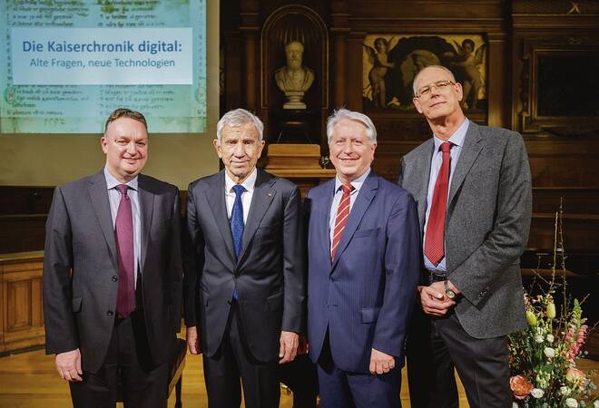
Another multi-million dollar project that has just been completed without a stumble is the Bibliotheca Palatina digitization. The press release flags an official ceremony on February 15 in Germany with Manfred Lautenschläger, the German millionaire who generously stumped up the cost of scanning the 3,000 Latin codices, and at the ceremony urged wealthy people to imitate his giving.

The digitization restores to Germany in virtual form a precious library that was spirited away from Heidelberg 400 years ago. This pioneering work, which was managed by Heidelberg University Library, benefited the wider Vatican project too, because the Germans set up a proper digitization studio at the Library in Rome and developed basic technical standards which are still in use.

The Rhein-Neckar Zeitung news report says the work got into high gear once the Vatican Library provided a second studio, but quotes Heidelberg chief librarian Veit Probst saying 402 Greek, 430 Hebrew and maybe several hundred unidentified Oriental manuscripts originally from Heidelberg still need to be digitized.

Now that two major funders have completed their projects, the big question now is: who is going to step up with a few million euros to sustain the digitization of the remaining 60,000 manuscripts.